Red Mountain (C) 13,238’
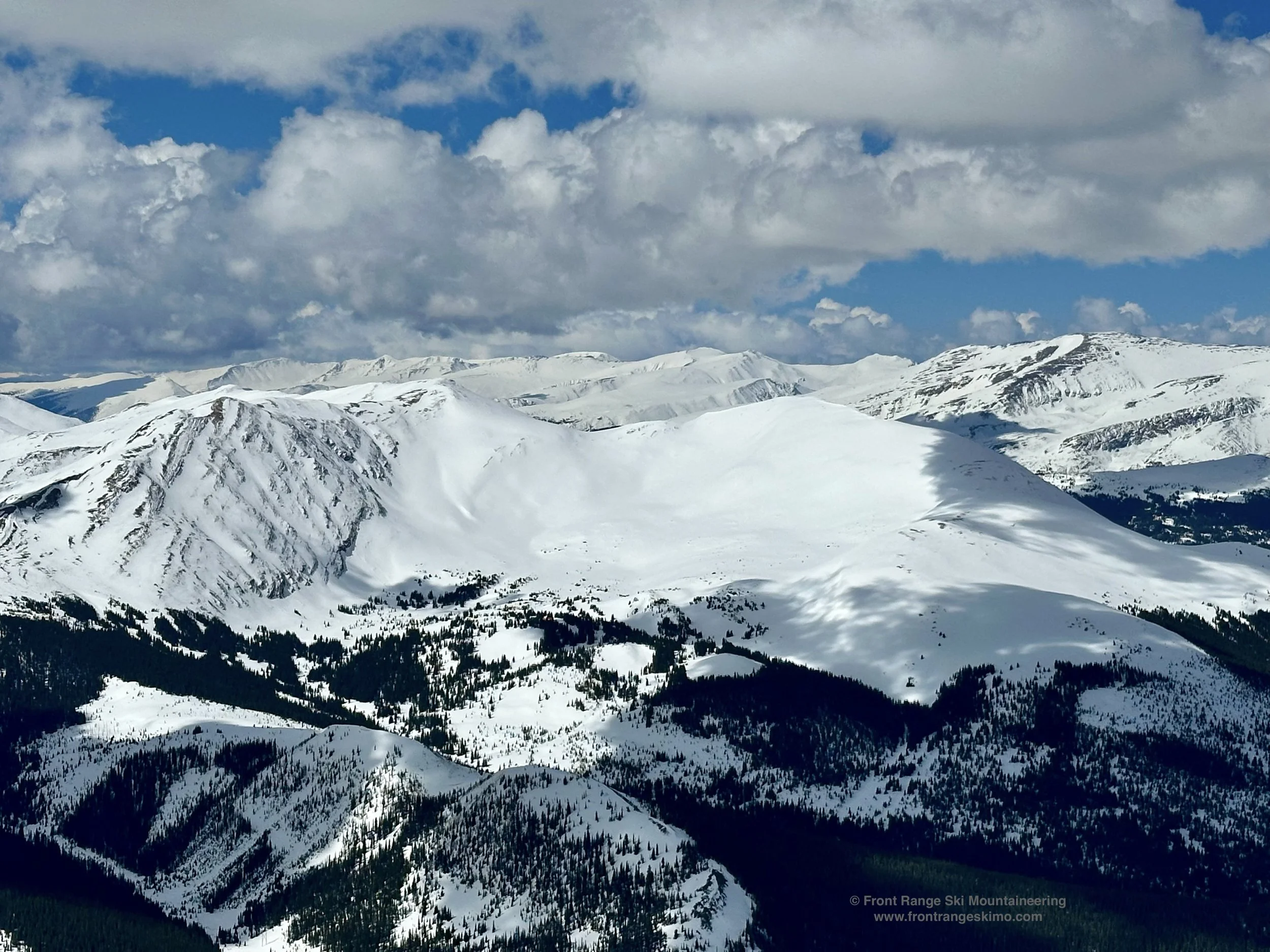
Red Mountain’s East Bowl viewed from Bald Mountain. Photo: Rob Writz
Red Mountain looms high over the small town of Blue River, south of Breckenridge. The steep and scrappy west side of the peak does not retain consistent snow until spring. The north and east side of the mountain have the best skiing terrain. The north slopes above Pennsylvania Creek hold excellent mid-winter powder skiing. These spacious tree and glade lines wrap from the north side to the east, and have numerous lines to explore. The East Bowl is a spectacular spring skiing bowl, and the climb up the the gentle North Ridge is a great outing for those first experiencing spring backcountry skiing and mountaineering.
+ ROUTES
1 - East Bowl
- Rating: II D5
- Average Angle, Steepest Angle: 15, 37
- ATES: 2, Challenging
- Season: Spring
- Exposure: East
- Vertical: 2,000'
- Approach Elevations: 10,322' - 13,238'
- Approach Distance from Pennsylvania Creek TH: 3.67 miles
- Top of the Route Waypoint: 39.39457, -106.02223
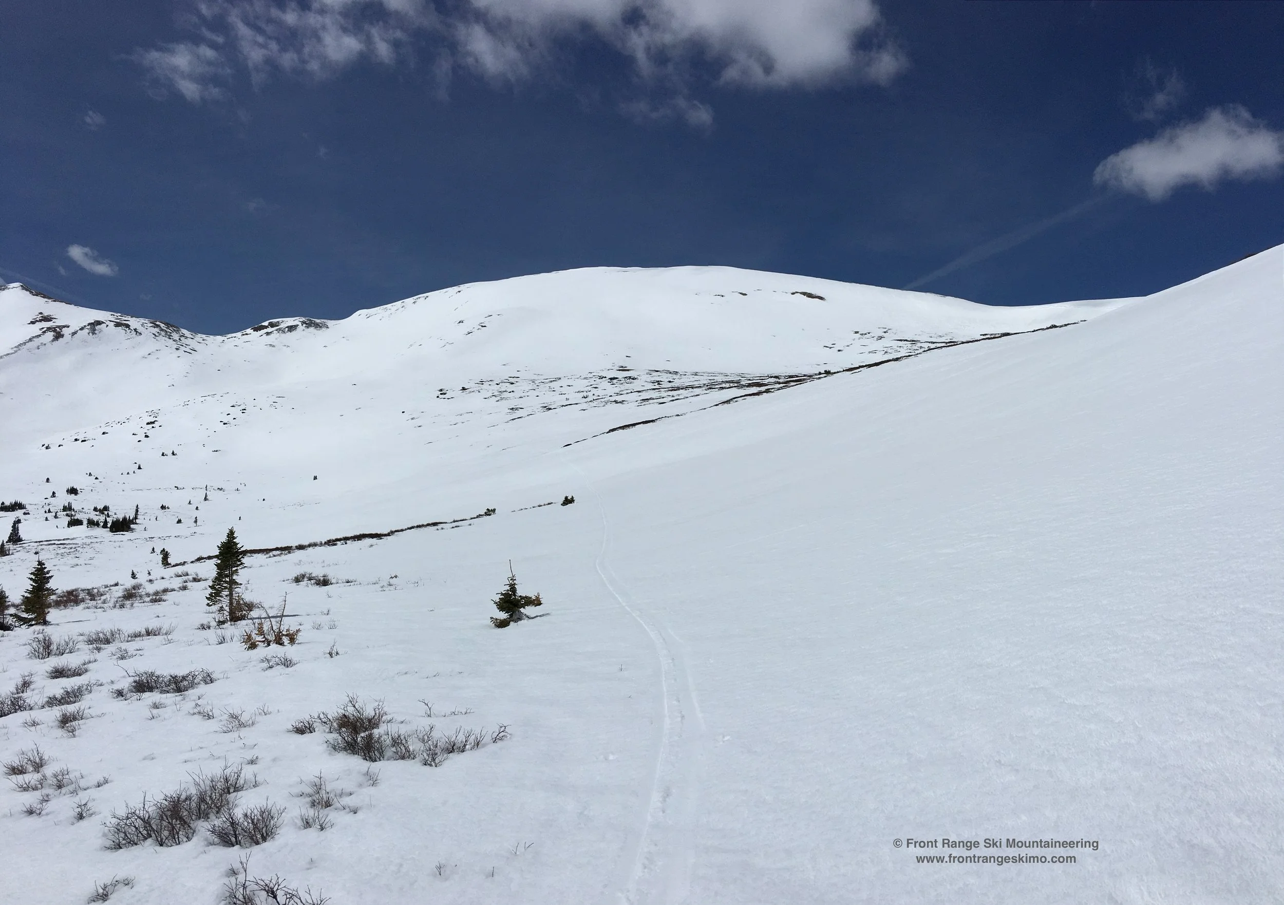
Red Mountain's East Bowl is one of the best spring skiing bowls in the Breckenridge area. This is a good destination for those new to ski and snowboard mountaineering, those acclimating to the area, or looking for a longer tour near Breckenridge. A great time to climb and ski this route is in April when the spring snow has consolidated, but enough snow remains for skiing in and out on the Pennsylvania Creek Road. The views from the summit are outstanding and include the Gore Range, Ten Mile Range, Mosquito Range, Bald Mountain, and the west side of the Front Range. The East Bowl descent starts right from the summit, and there is a briefly steep entrance before the route settles into classic open bowl skiing. After you harvest turns, trend skiers left into the valley to find Pennsylvania Creek Road, and follow this back to where you broke off for the ascent and then back to the trailhead.
From the trailhead, follow the Pennsylvania Creek Road south and uphill. You will quickly reach a switchback, and then continue on the road to the east. At approximately 1.25 miles from the start, reach a clearing and a view of the north slopes. Cross the valley and creek to the south, and directly climb the north slope's gladed terrain to treeline and the north ridge. Follow the north ridge south to the summit. Once you break treeline there are continuous views to keep you entertained, and you are able to skin for most of the ascent.
+ TRAILHEAD
Pennsylvania Creek (10,322)
This trailhead is in Blue River, south of Breckenridge. From the intersection of Highway 9 and Boreas Pass Road, go 3.4 miles south to Blue River and turn left on Blue River Road. Turn right on Regal Circle, then curve round to Coronet Drive. Follow Coronet Drive to its terminus at the trailhead.
+ MAPS & PICTURES
Below we have included a link to Front Range Skimo's master map. The routes on the map are approximations, and are not intended for use as a GPX track. To the right are a curated list of photos of the mountain.

Clicking on map above will open interactive Caltopo map website.