Lone Eagle Peak 11,919' and Iroquois 12,799'
Iroquois from the north. Photo: Rob Writz
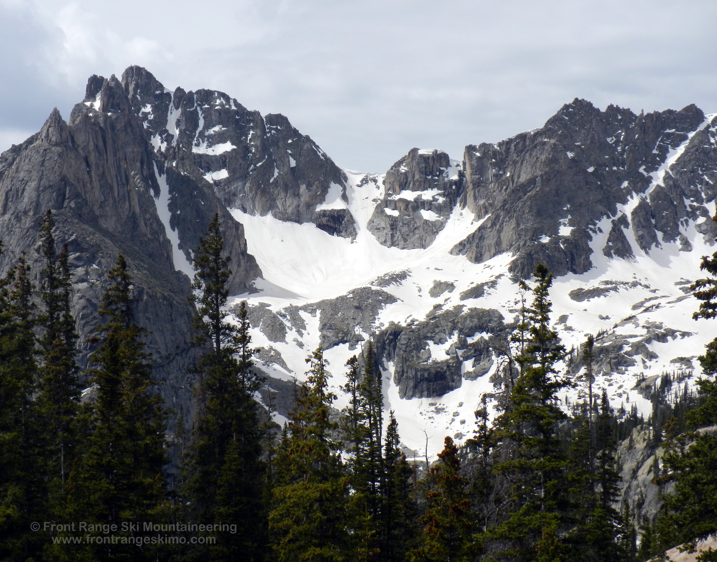
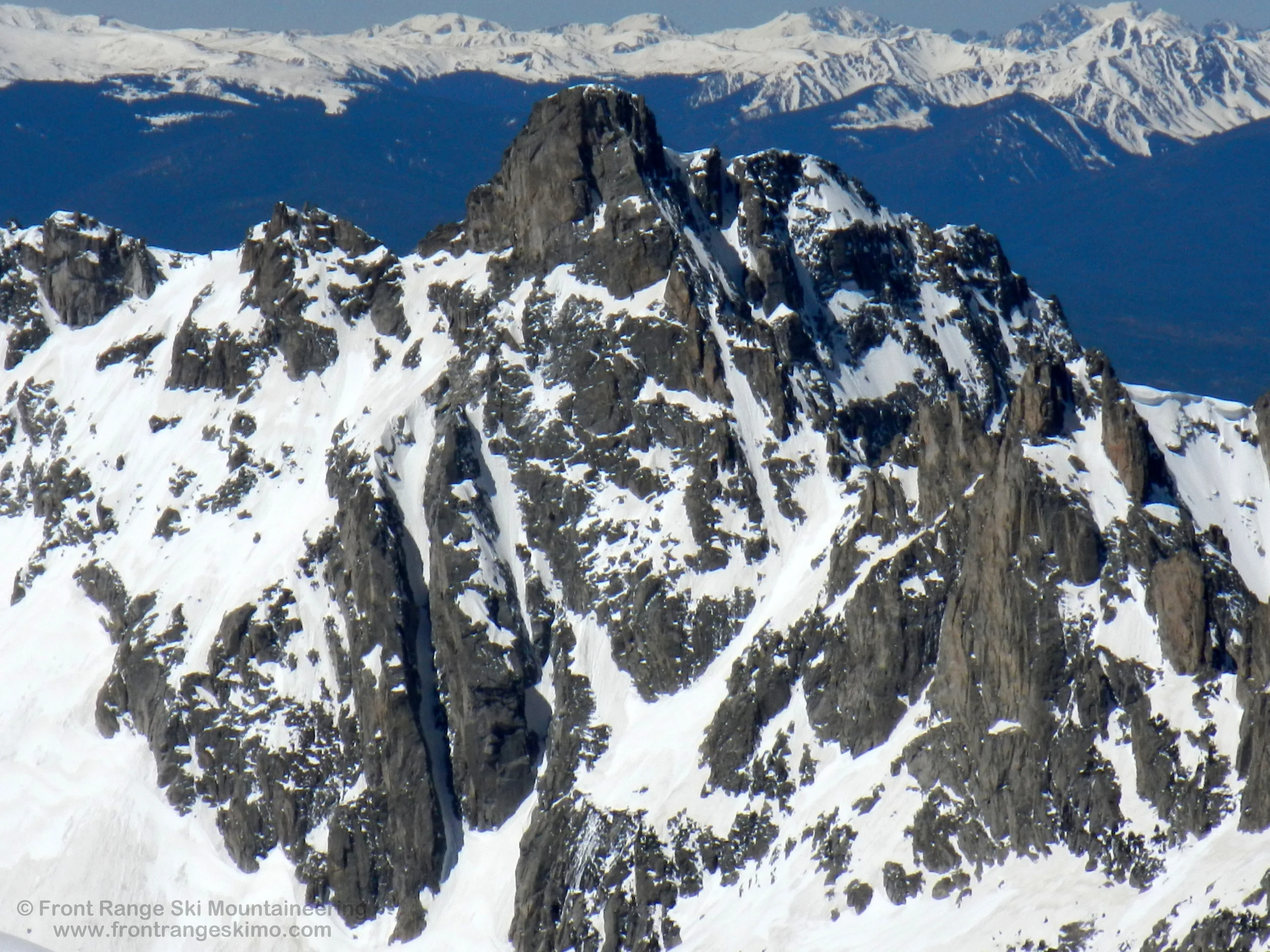
“Iroquois” is the common name given to the stunning tower that is the high point of the ridge containing Lone Eagle Peak and Limbo. This central position gives the peak a presence on both the East and West Rims of Lone Eagle Cirque. The northwest side of the peak holds the Peck Glacier and the bold Lone Rabbit Couloir. The east side of the peak rises above the Fair Glacier cirque and holds a series of complex couloirs and steep snowfields. As with all of the peaks and ski routes in the Lone Eagle Cirque, plan on spending several days camping in this area to optimize your trip.
+ ROUTES
Shared Approach to Lone Rabbit and Peck Glacier
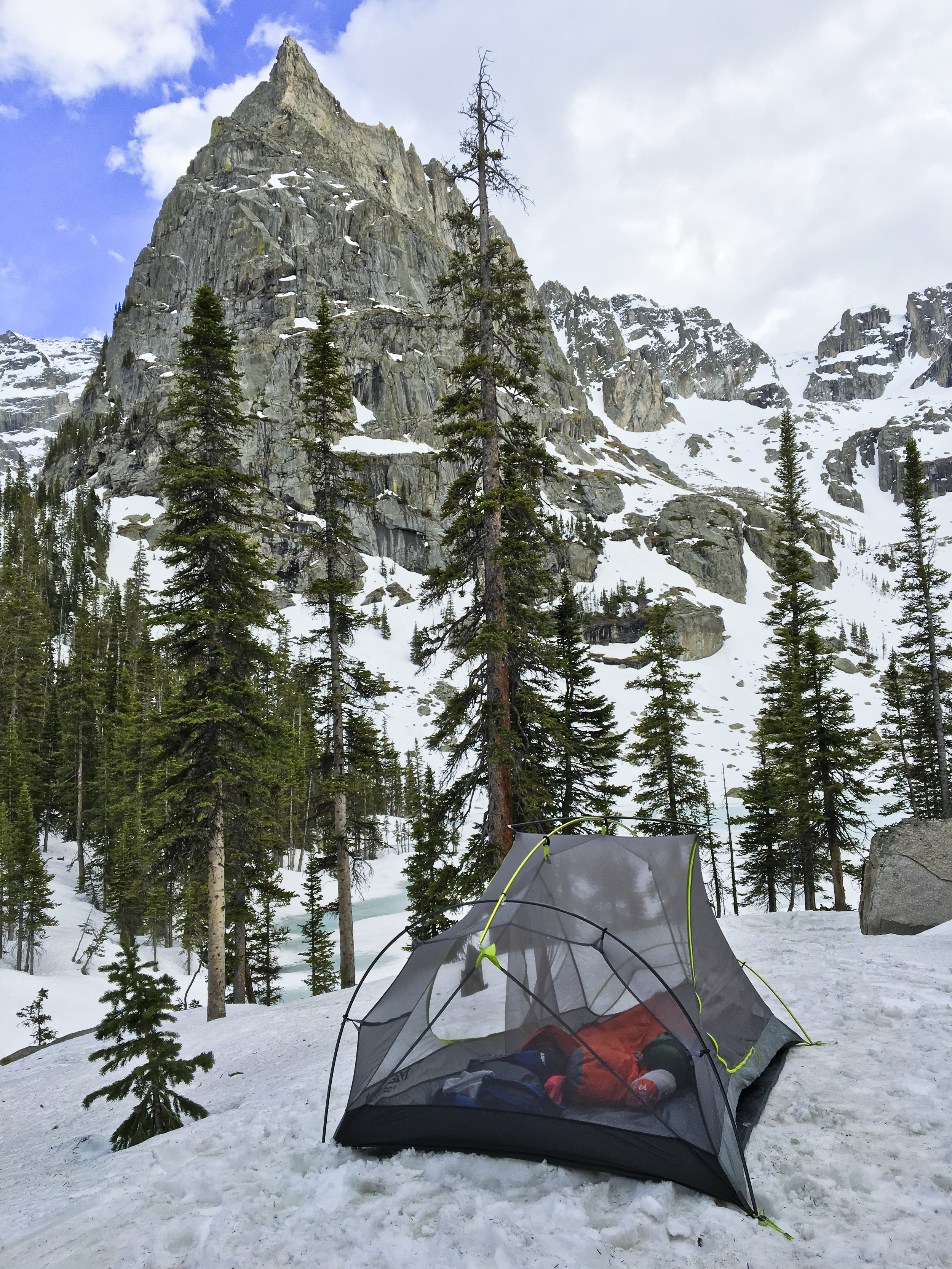
There are several ways to access the ski mountaineering routes in the cirques surrounding Lone Eagle. The approach that we describe here is to start at the Monarch Lake Trailhead southeast of Lake Granby in Grand County. This approach is straightforward and beautiful.. You should plan on spending several days in this area: one day to hike in, several days to ski from a basecamp, and one day to hike out. No matter how long you stay in this area you will leave wishing you had planned for several more days because it is that good.
Most Front Range skiers explore the Lone Eagle area after Memorial Day. The Cascade Creek Trail is often dry to just beyond the junction of the Crater Lake Trail (approximately 10,080’). You will want to bring hiking boots for the majority of the approach, skins for the valleys below the cirque, and crampons for the glaciers and snowfields.
From the Monarch Lake Trailhead follow the Cascade Creek Trail east across the north side of Monarch Lake. The trail continues eastward 3.1 miles to the intersection with the Buchanan Pass Trail. Hike on the Cascade Creek Trail to the southeast 2.7 miles to the junction with the Pawnee Pass Trail and Crater Lake Trail. Cross Pawnee Creek and go south on the Crater Lake Trail, and within a half mile look for a camping spot to the east (left) in lower angle and sometimes dry terrain. There is often snow at Crater Lake, and this positions north and east of Mirror Lake are good for a basecamp. From this area it is about a quarter mile southwest to Mirror Lake and then a quick jaunt to Crater Lake.
From Mirror Lake head southwest through the trees directly to Crater Lake. At Crater Lake there is a great view of Peck Glacier and Lone Rabbit. Head directly south along the east side of Crater Lake and below Lone Eagle Peak to the bottom of the snowfield leading to the Peck Glacier. Climb south up this first snow field to a small basin, and then pick your path to Glacier on the right and Lone Rabbit on the left.
Route 1 - Lone Rabbit
- Rating: V* D12
- Season: Spring, Summer
- Exposure: North
- Vertical: 1,700’
- Approach Elevations: 8,340’ – 12,000’
- Approach Distance: From Crater Lake: 0.85 miles, From Monarch Lake TH: 7.4 Miles
Lone Rabbit is the distinct couloir that frames the right side of Lone Eagle Peak. This couloir immediately catches the eye of any ski mountaineer, and it is one of the best pure couloir climbs and descents on the Front Range. The couloir resides below the “Limbo” peak that is between Iroquois and Lone Eagle Peak.
From the basin above Crater Lake and below the Peck Glacier, climb left up the obvious couloir. The upper portion of this couloir is the steepest point and it terminates at a fork leading to a pinnacled ridge of Limbo.
*These are Grade II routes from a high camp in the Lone Eagle Cirque.
Route 2 - Peck Glacier
- Rating: V*D7 R3
- Season: Summer
- Exposure: North
- Vertical: 2,340’
- Approach Elevations:8,340’ – 12,640’
- Approach Distance: From Crater Lake: 1.1 miles, From Monarch Lake TH: 8 Miles
The Peck Glacier is a fragmented permanent snowfield on the northwest side of Iroquois. This dark and shaded area sees little sunlight. Like the Fair Glacier, a winter snowpack may reside here into June. The Peck Glacier is somewhat small, but if you are skiing in this area in June you can frequently ski from any point on the Glacier to Crater Lake. The upper headwall of the Peck Glacier is significantly steeper, more complex, and dangerous (D17 R4) than the lower Glacier. A crevasse guards the hourglass-shaped transition from the Glacier to the headwall. This headwall is one of the steeper lines in the Indian Peaks and it is laced with cliffs and cornices. The climber’s left side of the cornice is often not overhanging and is a steep snow climb exit later in the spring and summer.
From the basin above Crater Lake and below the Peck Glacier, climb right of Lone Rabbit up a steep snow slope to the bottom of the glacier. From here you can choose to ski the glacier, the headwall, or a hidden and low angled couloir that takes you behind Lone Rabbit and just below the summit of “Limbo” (see pictures).
+ TRAILHEAD
Monarch Lake Trailhead (8,340’)
Monarch Lake Trailhead is on the west side of the Continental Divide east of Grand Lake and the town of Granby. From the town of Granby, drive north on Highway 34 to Lake Granby’s Rainbow Bay and turn east on County Road 6 towards Arapaho Bay. Follow this about 10 miles east to the Monarch Lake Trailhead.
This trailhead is in the Arapaho National Recreation Area. There is a $5 per day vehicle fee and you can learn more about it at the ANRA website. Additionally, a wilderness permit is required for camping in the Indian Peaks Wilderness. The Arapaho and Roosevelt National Forest website has more information on this. The Sulfur Ranger District headquarters in Granby is a good central location for information on the recreation area and the wilderness area.
+ MAPS & PICTURES
Below we have included a link to Front Range Skimo's master map. The routes on the map are approximations, and are not intended for use as a GPX track. To the right are a curated list of photos of the mountain.

Clicking on map above will open interactive Caltopo map website.